
England Vintage Original Antique Europe Maps & Atlases
999 Results
Geological Map Of The British Islands 4th Edition Sir William Pugh 32” x 25”
$39.96$14.93 shipping1924 POLAND Vintage Large Geographical Map ORIG. Italian 12.5 x 10.5" C13-1
$38.90$6.90 shippingOxfordshire Map Sapere Aude Copperplate Framed 1985 Janet Westman BB204
$84.50$40.00 shippingBritain Map Coppercraft Copper Etchings Pleasure Reproductions BB205
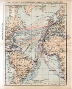
$124.50$40.00 shipping1904 ATLANTIC OCEAN SHIPPING COMPANY LINES RED STAR WHITE STAR LLOYD Map dated
$1.990 bids$9.00 shippingEnding Friday at 10:41AM PDT5d 3h1895 ENGLAND LONDON UNDERGROUND TUBE METRO and OTHER RAIL NETWORKS Antique Map
$1.990 bids$9.00 shippingEnding Friday at 10:43AM PDT5d 3hVintage Historical Folding Cloth Map Of England & Wales By L.G. Bullock 1965
$18.50$5.25 shippingVintage Map of ENGLAND Wall Art Railroad Decor Original 1950s Railway London
$9.95$4.95 shippingLarge Double Sided MAP of London Post office Directory kelly Vincent Brooks
$1.241 bid$9.94 shippingEnding Today at 11:51AM PDT4h 13mBartholomews Historical Map Of London Cloth + Geographia LONDON Street Plan
$25.00$5.80 shipping1927 Booklovers Map of the British Isles pictorial mounted framed P Paine Bowker
$165.00$25.62 shippingOriginal Map "Railway Map. No. 2. 1934." (London Tube Map) Henry C. Beck
$218.88$22.51 shipping1895 ENGLAND and WALES ISLE OF MAN GEOLOGICAL MAP Antique Map
$1.990 bids$9.00 shippingEnding Friday at 10:40AM PDT5d 3h1905 WORLD MERCATOR Currents Vintage Large Map ORIG. Italian 12.5 x 10.5" C13-1
$38.90$6.90 shippingVINTAGE ADMIRALTY CHART. No.1157. THE WASH, APPROACHES to BOSTON. 1951 Edition.
$48.78$21.10 shipping1902 INDUSTRIAL MAP GERMANY Vintage Economical ORIGINAL 11.5 x 9.5" C11-8
$24.90$6.90 shippingVintage ENGLAND Map Northern North LARGE Original Liverpool Wales 1920s
$19.51Was: $22.95$4.95 shipping1895 ENGLAND and WALES ISLE OF MAN Antique Map
$1.990 bids$9.00 shippingEnding Friday at 10:38AM PDT5d 3h1895 GREAT BRITAIN Vintage Map Isles North Sea London Original COLOR C12-3
$21.90$6.90 shippingOrdnance Survey one inch map of North Staffordshire. 1930
$5.630 bids$19.06 shippingEnding Wednesday at 11:39AM PDT3d 4hOPERATION OVERLORD - BASIC CONCEPTION OF THE ARMY PLAN - Rare WW2 Map 1944
$6.19$3.69 shipping1902 EUROPE CONTINENT Vintage Geographical Map Color 9.5 x 11.5 ORIGINAL C12-7
$29.90$6.90 shippingLONDON UNDERGROUND RAILWAYS - Mounted Vintage 1920s London Map
$18.75$15.01 shipping1940s Ordnance Survey Cloth Map The Border, ¼ Inch to mile ** [25983]
$5.62$5.63 shipping1746 Map of Hertfordshire England - Thomas Kitchin - Hartfordshire - Temperance
$69.95$12.00 shipping1897 EUROPE ECONOMICAL Map Vintage Ethnographic ORIGINAL 11.5 x 9.5" C11-8
$24.90$6.90 shipping1940s Ordnance Survey Cloth Map N Central England, ¼ Inch to mile **[25981]
$5.62$5.63 shippingVINTAGE ADMIRALTY CHART. No.2631. PORTSMOUTH HARBOUR. 1961 EDITION.
$61.29$21.53 shippingVINTAGE ADMIRALTY CHART. No.2151. RIVER THAMES, MUCKING FLATS. 1939 Edn
$73.79$25.04 shipping1898 Middle Europe Central Vintage Geographical Map ORIGINAL 19 x 9.5" C12-6
$32.90$6.90 shipping1956 Antique ENGLAND & WALES Atlas Map Hammond's Family Reference World Atlas
$19.70$6.70 shipping1909 BRITISH COLONIES MERCATOR Map Vintage Sea Travel ORIGINAL 11.5 x 9.5" C12-3
$24.90$6.90 shippingJohn Bartholomew Royal Map of England United Kingdom Scotland Kings and Queens
$12.00$4.00 shippingThe Times/Geographia Contour Road Map Hampshire Dorset Wiltshire
$8.13$20.64 shippingBartholomew's Town Plan of London, Wartime Printing, Antique Fold-Out Map
$49.95$8.45 shippingVTG 1964 National Geographic Shakespeare's Great Britain Ireland England Map
$3.99$5.90 shipping1895 ENGLAND WALES Vintage Geological Map North Sea German Original COLOR C10-8
$21.90$6.90 shipping1905 EUROPE MERCATOR Map Vintage Sea Travel Climate ORIGINAL 11.5 x 9.5" C11-8
$24.90$6.90 shipping6 Vintage 1950s BMC County Road Map And Gazetteer No 18,14,29,30,28,30
$18.750 bids$16.63 shippingEnding Monday at 12:00PM PDT1d 4hBenefits charityAntique Map The First Home Of The English And England In 550 History Dated 1905
$3.610 bidsEnding Thursday at 1:05PM PDT4d 5h$6.19 shippingWW1 Daily Chronicle War Map of Europe, linen backed [27724]
$56.27$8.76 shippingESSO Boat Cruising Guide River Thames Richmond to Lechdale 1962
$5.78$16.18 shipping1905 EUROPE POPULATION DENSITY Map Vintage Eng ORIGINAL 11.5 x 9.5" C12-7
$24.90$6.90 shippingVINTAGE BACON'S ISLE OF WIGHT FOLD OUT MAP 1960's ?
$6.25$21.20 shipping1905 EUROPE POPULATION DENSITY Map Vintage Eng ORIGINAL 11.5 x 9.5" C11-8
$24.90$6.90 shippingAntique 1960s London Map - Mounted - PADDINGTON, MARYLEBONE, HAMPSTEAD, REGENTS
$12.49$15.01 shipping1905 EUROPE MERCATOR Map Vintage Sea Travel Climate ORIGINAL 11.5 x 9.5" C12-2
$24.90$6.90 shipping1910 ORIGINAL VINTAGE MAP - England, Wales - C10-3
$21.90$6.90 shipping1897 DISTRIBUTION OF JEWS GERMANY Vintage Map ORIGINAL 11.5 x 9.5" C12-3
$24.90$6.90 shippingRare vintage WW2 Naval Map of HYTHE, Kent, 1943
$4.57$5.32 shipping1900 London England City Vintage Geography Map ORIGINAL 11.5 x 9.5" C12-9
$24.90$6.90 shippingVintage 1970s Map SW England S Wales Road Map Index A to Z Great Britain
$14.98$4.55 shippingVintage NORTHERN ENGLAND Map North Birmingham Liverpool Cambridge Scarborough
$14.41Was: $16.95$4.95 shippingGOREY, JERSEY, Channel Islands - Rare Vintage naval WW2 map 1943
$4.94$5.32 shipping1900 ENGLAND WALES Vintage Map York North Sea London German Original COLOR C10-9
$21.90$6.90 shipping1928 INDUSTRIAL MAP GERMANY Vintage Economical ORIGINAL 11.5 x 9.5" C12-6
$24.90$6.90 shippingRare vintage antique map of south of england EAST KENT , 1921 Ordnance Survey
$32.51$3.74 shipping1903 ENGLAND WALES Vintage Map York North Sea London German Original COLOR C10-8
$21.90$6.90 shipping


![1940s Ordnance Survey Cloth Map The Border, ¼ Inch to mile ** [25983]](https://i.ebayimg.com/thumbs/images/g/CMMAAOSwgidjU~nH/s-l300.jpg)


![1940s Ordnance Survey Cloth Map N Central England, ¼ Inch to mile **[25981]](https://i.ebayimg.com/thumbs/images/g/zUQAAOSwxh1jU~k7/s-l300.jpg)


![WW1 Daily Chronicle War Map of Europe, linen backed [27724]](https://i.ebayimg.com/thumbs/images/g/Vn4AAOSwJ3BklZmN/s-l300.jpg)


